
")
")


Linda van den Brink
Publications on Geodesy 93
2018, 232 pages.
Blending Geodetic Observations and Deformation Hypotheses
Hiddo Velsink
Publications on Geodesy 92
2018, 232 pages.
Sudan Xu
Publications on Geodesy 91
2015, 121 pages.
Biao Xiong
Publications on Geodesy 90
2014, 162 pages.

Bashar Saleem Abbas Alsadik
Publications on Geodesy 89
2014, 188 pages.

Angelina Nduta Mwenda
Publications on Geodesy 88
2015, 124 pages.
Established in the United States of America in 1970, Environmental Impact Assessment (EIA) is an interdisciplinary approach that considers the anticipated impacts of development on the environment, and proposes timely mitigation of these impacts to the extent possible. Since then EIA has continued to be established in countries worldwide, with modifications being made to suit regional and local...
Three cases from a peri-urban context
Paul van Asperen
Publications on Geodesy 87
2014, 293 pages.
Sub-Saharan Africa is urbanizing at a rapid pace. A major problem is that countries lack appropriate tools to manage this urban growth. When governments fail to deliver plots suitable for development, citizens will access land by informal routes and thereby become vulnerable to eviction. The ensuing fear of...
Freek van Leijen
Publications on Geodesy 86
2014, 195 pages.
Satellite radar interferometry (InSAR) is a powerful technique to measure motion of the Earth’s surface. However, the applicability of the conventional approach is limited due to error sources: temporal decorrelation, geometric decorrelation, and atmospheric signal delay. Radar interferometric time series approaches have been developed to...
Hamayun
Publications on Geodesy 85
2014, 161 pages.
The research presented in this dissertation is aimed at developing advanced proce-
dures for the recovery of global Moho geometry...
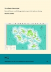
Michiel Jellema
Dynamics between government organisations and geo-information provision
Publications on Geodesy 84
2014, 360 pages. ISBN (print): 978-90-5199-532-9. ISBN (online): 978-90-5199-533-6.
The Information Archipelago, the title of this study, is a group of islands which provides knowledge or insight. This group of islands – in this study – represent the society and several islands are government organisations. Each island develops itself and an island-specific geo-information function takes care of day-to-day business. A national geo-information infrastructure connects...
Hassan Hashemi Farahani
Publications on Geodesy 83
Delft, 2013. 212 pagina's. ISBN: 978 90 6132 345 7.
Modelling the Earth's static and time-varying gravity field using a combination of GRACE and GOCE data The main focus of the thesis is modelling the static and time-varying parts of the Earth's gravity field at the global scale based on data acquired by...

D.C. Slobbe
Publications on Geodesy 82
Delft, 2013. 263 pagina's. ISBN: 978 90 6132 344 0. Alleen verkrijgbaar als pdf.
Dutch waters lack an accurate and easily accessible 3D description of the lowest astronomical tide (LAT) surface, i.e., a so-called “separation model”. This tidal datum, defined as “the lowest tide level that can be predicted to occur under average meteorological conditions and under any combination of astronomical conditions” (International Hydrographic Organization 2011a, Technical Resolution 3/1919), is, in those regions where tides have an appreciable effect on...
Applications for the Roer Valley Graben and coal mine induced displacements in the southern Netherlands
Miguel Caro Cuenca
Publications on Geodesy 81
Delft, 2013. 166 pagina's. ISBN: 978 90 6132 341 9. Alleen verkrijgbaar als pdf.
Radar interferometry (InSAR) is a valuable tool to measure surface motion. Applying time series techniques such as Persistent Scatterer Interferometry (PSI), InSAR is able to provide surface displacements maps with mm-precision. However, InSAR can still be...
Shizhuo Liu
Publications on Geodesy 80
Delft, 2013. 230 pagina's. ISBN: 978 90 6132 340 2. Alleen verkrijgbaar als pdf.
Satellite SAR Interferometry (InSAR) is frequently promoted as an active, allweather technique in comparison to optical remote sensing techniques that need solar illumination and cloud free conditions. However, the earth’s atmospheric refractivity plays an...

Deriving Portugal Country Model from the Land Administration Domain Model
João Paulo Hespanha
Publications on Geodesy 79
Delft, 2012. 363 pagina's. ISBN: 978 90 6132 337 2. Alleen verkrijgbaar als pdf.
This Thesis describes the research process followed in order to achieve a development methodology applicable to the reform of cadastral systems with a legal basis.
It was motivated by the author’s participation in one of the first surveying and mapping operations for a digital cadastre in Portugal, and the problems faced by the cadastre, and more generally, the Land Administration System in Portugal.
After approaching Delft University of...
Publications on Geodesy 78
Delft, 2012. 244 pagina's. ISBN: 978 90 6132 336 5. Alleen verkrijgbaar als pdf.
A Domain Model for Land Administration is designed in this thesis. There is a need for domain specific standardisation to capture the semantics of the land administration domain on top of the agreed foundation of basic standards for geometry, temporal...
Martijn Meijers
Publications on Geodesy 77
Delft, 2011. 244 pagina's. ISBN: 978 90 6132 335 8. Alleen verkrijgbaar als pdf.
The use of geo-information is changing by the advent of newmobile devices, such as tablet-pc's that harness a lot of computing power. This type of information is more and more applied in mainstream digital consumer products, in a netcentric ...

Lucasz Grus
Publications on Geodesy 76
Delft, 2010. 171 pagina's. ISBN: 978 90 6132 320 4.
Over the last two decades many countries throughout the world have taken steps to establish national Spatial Data Infrastructures (SDls). These actions have sought to provide an infrastructure for accessing and sharing spatial data to reduce...

Shi Pu
Publications on Geodesy 75
Delft, 2010. 133 pagina's. ISBN: 978 90 6132 319 8.
Various applications demand realistic 3D city models. For urban planning, analyzing in a 3D virtual reality world is much more efficient than imaging the 2D information on maps. For public security, accurate 3D building models are indispensable to make...

Sander Oude Elberink
Publications on Geodesy 74
Delft, 2010. 194 pagina's. ISBN: 978 90 6132 318 1.
Our research covers the automation in acquiring three dimensional (3D) topographic objects. The research tasks focus on two specific objects: roads and buildings. These objects are of high importance in 3D city models as they are two major topographic classes...
B. Wouters
Publications on Geodesy 73
Delft, 2010. 194 pagina's. ISBN: 978 90 6132 316 7.
Recently, the Intergovernmental Panel on Climate Change named sea level rise as one of the major challenges of the 21st century. Given the high population density of coastal regions, a small rise of the sea level will have a substantial impact on...

Tobias Wittwer
Publications on Geodesy 72
Delft, 2009. 213 pagina's. ISBN: 978 90 6132 315 0.
Terrestrial gravimetry, airborne gravimetry, and the recent dedicated satellite gravity missions Challenging Minisatellite Payload (CHAMP), Gravity Recovery and Climate Experiment (GRACE), and Gravity and Ocean Circulation Explorer (GOCE) provide us with high-quality, high-resolution gravity data, which are used in many application areas such as...
Y. Memarzadeh
Publications on Geodesy 71
Delft, 2009. 236 pagina's. ISBN: 978 90 6132 314 3.
The main objective of this thesis is to develop a procedure for modeling and predicting ionospheric Total Electron Content (TEC) for high precision differential GNSS applications. As the ionosphere is a highly dynamic medium, we believe that to have...
Bas Alberts
Publications on Geodesy 70
Delft, 2009. 200 pagina's. ISBN: 978 90 6132 312 9.
Regional gravity field modeling using airborne gravimetry data Airborne gravimetry is the most efficient technique to provide accurate high-resolution gravity data in regions that lack good data coverage and that are difficult to access otherwise. With current airborne gravimetry systems gravity can be obtained at a spatial resolution of 2 km with an accuracy of 1-2 mGal. It is therefore an ideal technique to complement ongoing satellite gravity missions and establish the basis for many applications of regional gravity field modeling. Gravity field determination using airborne gravity data can be divided in two major steps.
Leendert Louis Dorst
Publications on Geodesy 69
Delft, 2009. 224 pagina's. ISBN: 978 90 6132 311 2.
Safe nautical charts require a carefully designed bathymetric survey policy, especially in shallow sandy seas that potentially have dynamic sea floor patterns. Bathymetric resurveying at sea is a costly process with limited resources, though. A pattern on the sea floor known as tidal sand waves is clearly present in bathymetric surveys, endangering navigation in the Southern North Sea because of the potential dynamics of this pattern. An important factor in an efficient resurvey policy is the type and size of...
Xianglin Liu
Publications on Geodesy 68
Delft, 2008. 248 pagina's. ISBN: 978 90 6132 309 6.
This thesis is focused on the development of new techniques for global gravity field recovery from high-low (hl) and low-low (ll) satellite-to-satellite tracking (SST) data. There are a number of approaches to global gravity field recovery known from literature, including the variational equations approach, short arc approach, energy balance approach and acceleration approach. The focus of...
Jasper van Loon
Publications on Geodesy 67
Delft, 2008. 248 pagina's. ISBN: 978 90 6132 307 5.
The gravitational field of the Earth is caused by the heterogeneous mass distribution of the Earth. Due to this field, the mean sea level (at rest) shows fluctuations (geoid heights) up to 100 meters with respect to a reference ellipsoid. The time-varying gravity signal is a source of information on the melting of the polar ice, the hydrological cycle and other mass variations within the Earth. Moreover, the gravity field of the Earth is needed to derive the physical (orthometric) heights and to estimate the ocean at rest, which is necessary for...
Friso Penninga
Publications on Geodesy 66
Delft, 2008. 204 pagina's. ISBN: 978 90 6132 304 4.
This dissertation presents a new topological approach to data modelling, based on a tetrahedral network. Operators and definitions from the field of simplicial homology are used to define and handle this structure of tetrahedrons. Simplicial homology provides a solid mathematical foundation for the data structure and offers full control over orientation of simplexes and enables one to derive substantial parts of the TEN (TEtrahedronised irregular Networks) structure efficiently, instead of explicitly storing all primitives. DBMS characteristics as...
Rodney James Thompson
Publications on Geodesy 65
Delft, 2007. 336 pagina's. ISBN: 978 90 6132 303 7.
The storage and retrieval of spatial data in computer systems has matured greatly over recent years, from the earliest approaches (of simple digitised linework and text) to the representation of features and their attributes, with the semantics of their behaviour associated. This has led to massive cost savings where data, which might have been captured for a specific purpose, can be shared and reused for other purposes.
Ali Reza Amiri-Simkooei
Publications on Geodesy 64 Delft, 2007. 220 pagina's.
ISBN: 978 90 6132 301 3.
Data processing in geodetic applications often relies on the least-squares method, for which one needs a proper stochastic model of the observables. Such a realistic covariance matrix allows one first to obtain the best (minimum variance) linear unbiased estimator of the unknown parameters; second, to determine a realistic precision description of the unknowns; and, third, along with the distribution of the data, to correctly perform hypothesis testing and assess quality control measures such as reliability. In many practical applications the covariance matrix is only partly known. The covariance matrix is then usually written as an unknown linear combination of known cofactor matrices.

Rob Lemmens
Publications on Geodesy 63, Delft, 2006. 308 pagina's.
ISBN-13: 978 90 6132 298 6. ISBN-10: 90 6132 298 7.
The last two decades have shown a major shift from stand-alone software systems to networked ones. As with all information system domains, Geographic Information Systems (GISs) have been influenced to a large extent by recent internet developments, resulting in...
Tahir Rabbani Shah
Publications on Geodesy 62, Delft, 2006. 194 pagina's.
ISBN-13: 978 90 6132 297 9. ISBN-10: 90 6132 297 9.
Up to date and accurate 3D models of industrial sites are required for different applications like planning, documentation and training. Traditional methods for acquiring as-built information like manual measurements by tape and tacheometry are not only slow and cumbersome but most of the time they also fail to provide the amount of detail required. Many industrial facilities provide a limited personnel access because of the presence of radioactive, toxic...
Remco Kroes
Publications on Geodesy 61, Delft, 2006. 184 pagina's.
ISBN-13: 978 90 6132 296 2. ISBN-10: 90 6132 296 0.
Spacecraft formation flying is currently considered as a key technology for advanced space missions. Compared to large individual spacecraft, the distribution of sensor...
Pepijn van Oort
Publications on Geodesy 60, Delft, 2005. 140 pagina's.
ISBN-13: 978 90 6132 295 5. ISBN-10: 90 6132 295 2.
The growing availability of spatial data along with growing ease to use the spatial data (thanks to wide-scale adoption of GIS) have made it possible to use spatial data in applications inappropriate considering the quality of the data. As a result, concerns about spatial data quality have increased. To deal with these concerns, it is necessary to (1) formalise and standardise descriptions of spatial data quality and (2) to apply these descriptions in assessing the suitability (fitness for use) of spatial data, before using...
George Sithole
Publications on Geodesy 59, Delft, 2005. 204 pagina's.
ISBN-13: 978 90 6132 292 4. ISBN-10: 90 6132 292 8.
Various methods have been developed to measure the physical presence of objects in a landscape with high positional accuracy. A new method that has been gaining popularity is Airborne Laser Scanning (ALS). ALS works by scanning a landscape (the collection of ground, buildings, vegetation, etc.,) in multiple passes. In each scan pulses of

Sandra Verhagen
Publications on Geodesy 58, Delft, 2005. 194 pagina's.
ISBN-13: 978 90 6132 290 0. ISBN-10: 90 6132 290 1.
Fast and high precision relative positioning with a Global Navigations Satellite System (GNSS) is only possible by using the very precise carrier phase measurements. However, these carrier phases are ambiguous by an unknown number of cycles. The knowledge that the ambiguities are integer-valued has been exploited in...
Jantien E. Stoter
Publications on Geodesy 57, Delft, 2004. 346 pagina's.
ISBN-13: 978 90 6132 286 3. ISBN-10: 90 6132 286 3. € 10,50
In the current cadastral registration the parcel is the basic entity for the registration of property rights to real estate. The right of ownership to a parcel gives the right to use the volume above and below the parcel. As long as there is only one user on...
Frank Kleijer
Publications on Geodesy 56, Delft, 2004. 282 pagina's.
ISBN-13: 978 90 6132 284 9. ISBN-10: 90 6132 284 7.
In the Netherlands, a precision of 5 mm for estimated GPS height differences is required to achieve comparable accuracy as geoid height differences. This precision can be achieved for 24-hour data sets when applying a proper modeling. Precise leveling with GPS requires a judicious modeling of tropospheric delays, which has physical, functional, and stochastic aspects. The physical modeling comprises zenith delays for..
A new approach to the conceptual generalisation of geographic databases
J.W.N. van Smaalen
Publications on Geodesy 55, Delft, 2003. 104 pagina's.
ISBN-13: 978 90 6132 282 5. ISBN-10: 90 6123 282 0.
Since the late 1960's automated methods for map generalisation have been studied, but thus far no comprehensive system has been achieved. This is due to the general complexity of the matter, part of which is caused by the inability to separate the conceptual and the graphic issues. These aspects of...
Line-Photogrammetry for the Reconstruction from Single and Multiple Images
Frank van den Heuvel
Publications on Geodesy 54, Delft, 2003. 206 pagina's.
ISBN-13: 978 90 6132 281 8. ISBN-10: 90 6123 281 2.
Architectural photogrammetry has been practised for more than a century with the documentation of cultural heritage as its main objective. Since the introduction of the computer, and later the digital camera, research in photogrammetry aims at automation. This thesis reports on research on automation in architectural photogrammetry for efficient reconstruction of detailed building models from one or...
ldikó Süveg
Publications on Geodesy 53, Delft, 2003. 155 pagina's.
ISBN-13: 978 90 6132 280 1. ISBN-10: 90 6123 280 4.
The 3D reconstruction of buildings has numerous applications in areas that include urban planning, construction, environment, construction, transportation, energy and property management, tourism, and virtual tours of cities. In this thesis, the reconstruction of 3D building models from...
Dennis Odijk
Publications on Geodesy 52, Delft, 2002. 262 pagina's.
ISBN-13: 978 90 6132 278 8. ISBN-10: 90 6123 278 2.
In many geodetic (surveying) applications positions of objects need to be determined with high precision (cm-accuracy or even better). The Global Positioning System (GPS) is very suitable for this purpose. High positioning accuracy is in principle feasible when a relative measurement setup is used and in...
Jaap Zevenbergen
Publications on Geodesy 51. Delft, 2002. 224 pagina's.
ISBN-13: 978 90 6132 277 1. ISBN-10: 90 6123 277 4.
This study looks at ‘Systems of land registration’, and particularly at aspects (of these systems) and their effects (on the well functioning of these systems). The focus is on the technical, legal, and organizational aspects of systems of land registration and their interrelations, and the effects thereof on...
Marc Crombaghs, Erik de Min, Govert Strang van Hees
Publications on Geodesy 50, Delft, 2002. 31 pagina's.
ISBN-13: 978 90 6132 275 7. ISBN-10: 90 6123 275 8.
The determination of the earth’s gravity field is done for various reasons...
K.I. van Onselen
Publications on Geodesy 49, Delft, 2000, 220 pagina's.
ISBN-13: 978 90 6132 273 3. ISBN-10: 90 6132 273 1.
For low-lying areas like the Netherlands, an ever-increasing sea level can become a serious threat. This is especially true if sea level rise accelerates, e.g., due to greenhouse-gas induced warming. To anticipate potential troubles, it is important to have a good estimate of the expected behaviour of ...
J. Bouman
Publications on Geodesy 48, Delft, 2000. 123 pagina's.
ISBN-13: 978 90 6132 270 2. ISBN-10: 90 6132 270 7.
A global model of the Earth’s gravity field may be derived from satellite observations such as satellite tracking observations or satellite gravity gradiometry (SGG). Due to the satellite’s altitude above the Earth’s surface, the gravity field recovery from satellite data is an ill-posed problem since it lacks stability. In addition, the spatial data distribution is heterogeneous in...
L. Heres
Publications on Geodesy 47, Delft, 2000. 70 pagina's.
ISBN-13: 978 90 6132 269 6. ISBN-10: 90 6123 269 3.
Most Geographic Information Systems started as a substitute for loose paper maps. These paper maps did not have a built-in time dimension and could only represent history indirectly as a sequence of physically separate images. This was in fact imitated by these first...
P.J. de Jonge
Publications on Geodesy 46, Delft, 1998. 240 pagina's.
ISBN-13: 978 90 6132 266 5. ISBN-10: 90 6132 266 9.
The objective of this thesis is the development of a geodetic data reduction model for the use of the GPS for high precision relative positioning, with an emphasis on static network applications. The following aspects can be distinguished: optimum use of available data, estimability of parameters the use of an efficient estimation method for the estimation of both the continuous and integer parameters, and the development of...
C.C.J.M. Tiberius
Publications on Geodesy 45, Delft, 1998. 264 pagina's.
ISBN-13: 978 90 6132 265 8. ISBN-10: 90 6132 265 0.
Through the concept of interferometry and using carrier phase measurements, relative positions can be determined very precisely with the Global Positioning System GPS. Carrier phase measurements are made by phase comparison of the generated and received carrier. Due to this technique, an unknown integer number of...
Marlies de Gunst
Publications on Geodesy 44, Delft, 1996. 192 pagina's.
ISBN-13: 978 90 6132 259 7. ISBN-10: 90 6132 259 6.
In modem map production a shift took place from analogue maps to maps in digital format, stored in Geographic Information Systems (GIS). Because of the advantages of GIS, this development caused a wider use of topographic data and therefore a larger demand. To be effective, GIS depends on...
Martien Molenaar (eds.)
Publications on Geodesy 43, Delft, 1996. 78 pagina's.
ISBN-13: 978 90 6132 258 0. ISBN-10: 90 6132 258 8.
Multi-scale approaches form at present one of the focal points of the GIS research community. This is due to the rising awareness that many processes on the earth surface can only be monitored and managed if they are understood in their geographical context. Part of this context is defined by...
P.G. Sluiter
Publications on Geodesy 42, Delft, 1995. 98 pagina's.
ISBN-13: 978 90 6132 255 9. ISBN-10: 90 6132 255 3.
On 31 January 1994, the Anti Spoofing (AS) feature was activated by the GPS control segment. This restricts the capabilities of conventional two frequency GPS receivers. Several manufacturers of geodetic receivers have developed methods to overcome most of the adverse effects of AS...
W. Baarda
Publications on Geodesy 41, Delft, 1995. 148 pagina's.
ISBN-13: 978 90 6132 253 5. ISBN-10: 90 6132 253 7.
Martien Molenaar and Sylvia de Hoop (eds.)
Publications on Geodesy 40, Delft, 1994. 259 pagina's.
ISBN-13: 978 90 6132 249 8. ISBN-10: 90 6132 249 9.
The conference calendar of 1994 showed a coincidence of two international meetings with an overlap in their field of interest. These were the international symposium on Spatial Data Handling (SDH) in Edinburgh and the symposium of ISPRS Commission III in Munich, both in the week from...
Reiner Rummel, Martin van Gelderen, Radboud Koop, et al.
Publications on Geodesy 39, Delft, 1993. 120 pagina's.
ISBN-13: 978 90 6132 247 4. ISBN-10: 90 6132 247 2.
In 1988 the European Space Agency started with a series of studies with the goal to prepare the geodetic user community for a dedicated gravity field mission and stimulate cooperation among various groups. Thereby it was left open whether the planned mission should be based on the principle of satellite-to-satellite...
Radboud Koop
Publications on Geodesy 38, Delft, 1993. 240 pagina's.
ISBN-13: 978 90 6132 246 7. ISBN-10: 90 6132 246 4.
The gravitational field of the earth can be determined globally and with high precision and resolution by means of a combined Satellite Gravity Gradiometry (SGG) and Satellite-to-Satellite Tracking (SST) mission. In such a mission a spacecraft...
Martin Salzmann
Publications on Geodesy 37, Delft, 1993. 216 pagina's.
ISBN-13: 978 90 6132 245 0. ISBN-10: 90 6132 245 6.
This thesis deals with the data processing, testing, and design procedures for use in dynamic systems, particularly integrated navigation systems, and provides a unified theoretical framework for these procedures. The data processing procedure - the Kalman fllter - is analysed from a least squares point of view as this method provides a better understanding of some aspects of...
J.C. de Munck and T.A.Th. Spoelstra (eds.)
Publications on Geodesy 36, Delft, 1992. 197 pagina's.
ISBN-13: 978 90 6132 243 6. ISBN-10: 90 6132 243 X.
It is with great pleasure that the Netherlands Geodetic Commission presents the proceedings of the "Symposium on Refraction of Transatmospheric Signals in Geodesy"...
Martin van Gelderen
Publications on Geodesy 35, Delft, 1991. 143 pagina's.
ISBN-13: 978 90 6132 241 2. ISBN-10: 90 6132 241 3.
In this thesis, the geodetic boundary value problem (GBVP) for a completely hypothetical earth is developed. As already shown in (Gerontopoulos, 1978) the complete GBVP for a 2D earth can be set up. It can serve as an example for the real 3D one, with the advantage of less complex mathematics...
Xu Peiliang and Reiner Rummel
Publications on Geodesy 34, Delft, 1991. 51 pagina's.
ISBN-13: 978 90 6132 240 5. ISBN-10: 90 6132 240 5.
Vertical datum connection is investigated from the view point of quality, i. e. accuracy, reliability and detectability, based on the method originally proposed by Rummel and Teunissen (1988). Three simulations are carried out. The levelling accuracy is assumed to be 1 mm/km and the position accuracy of space...
E.J.O. Schrama
Publications on Geodesy 33, Delft, 1989. 167 pagina's.
ISBN-13: 978 90 6132 239 9. ISBN-10: 90 6132 239 1.
The problem of radial orbit errors in processing of satellite altimeter data is largely due to the inaccuracy of the gravity model which is required for the computation of the trajectory of the spacecraft. A commonly used technique for removing these errors consists of minimizing the crossover differences of profiles measured by the altimeter...
R.H.M. Haagmans, G.J. Husti, P. Plugers, et al.
Publications on Geodesy 32, Delft, 1988. 135 pagina's.
ISBN-13: 978 90 6132 237 5. ISBN-10: 90 6132 237 5.
In April 1986 extented test measurements were executed with GPS instruments on board of the Dutch Navy vessel Hr. Ms. Tydeman. The GPS positions were compared with the best available terrestrial radio navigation systems, under variable conditions. The precision of GPS turned out to be 10 to 15 m in absolute position, and better than 3 m in differential ...
H. van der Marel
Publications on Geodesy 31, Delft, 1988. 135 pagina's.
ISBN-13: 978 90 6132 237 5. ISBN-10: 90 6132 237 5.
In this thesis several aspects of the scientific data reduction for the astronomical satellite Hipparcos are discussed. The Faculty of Geodesy of the -Delft University of Technology participates in the data reduction in the framework of the international FAST consortium. Hipparcos (an acronym for HIgh Precision PARallax Collecting Satellite) is scheduled for launch in the spring of 1989 under supervision of...
P.J.G. Teunissen
Publications on Geodesy 30, Delft, 1985. 177 pagina's.
ISBN-13: 978 90 6132 233 7. ISBN-10: 90 6132 233 2.
This publication discusses...
F.J.J. Brouwer
Delft, 1985. 180 pagina's.
ISBN-13: 978 90 6132 232 0. ISBN-10: 90 6132 232 4.
The accuracy of geodetic VLBI point positioning measurements is assessed. The assessment is based on a software package developed for the purpose which incorporates all possible computing models for geodetic VLBI data analysis. Analysis of real and simulated data with this package shows that an accuracy of 10 cm in point positioning has been achieved with the ERIDOC and MERIT Short Campaign observing campaigns. This analysis...
Oscar L. Colombo
Delft, 1984. 253 pagina's.
ISBN-13: 978 90 6132 230 6. ISBN-10: 90 6132 230 8.
This is a report on a method for the detailed and global mapping of the planetary gravitational field using two artificial satellites that carry devices to track each other along the same near-circular, near-polar orbit, separated by...
H. Quee
Delft, 1983. 110 pagina's.
ISBN-13: 978 90 6132 227 6. ISBN-10: 90 6132 227 8.
In this study a functional model for the adjustment of spatial geodetic networks is described. The model can be used both for terrestrial first order networks including astronomical observation variates and for engineering surveys, e.g. for the measurement of deformations, or for setting...
M. Molenaar
Delft, 1981. 77 pagina's.
ISBN-13: 978 90 6132 226 9. ISBN-10: 90 6132 226 X.
Chapter II defines S-systems and S-transformations in a general way. In relation to these, definitions for K-systems and K-transformations follow. The former give stochastic coordinate transformations, whereas the latter give non-stochastic transformations...
W. Baarda
Publications on Geodesy 25 (Vol. 6 Nr. 4), Delft, 1979, 110 pagina's.
ISBN-13: 978 90 6132 225 2. ISBN-10: 90 6132 225 1.
The sketch given here evolved as a spare time activity from the presentation and discussion of the paper IBjerhammer, 1962]. The struggle with the subject concerned the main lines: not all mathematical details have been satisfactorily solved...
G.J. Husti
Delft, 1978. 68 pagina's.
ISBN-13: 978 90 6132 224 5. ISBN-10: 90 6132 224 3.
Deviations of the vertical in The Netherlands were until recently known from latitude and azimuth observations carried out in the years 1893-1899 from gravimetrical measurements carried out by Vening Meinesz in the years 1913-1921, and from a number of Laplace stations measured in the period 1947-1973...
D.L.F. van Loon and T.J. Poelstra
Delft, 1976. 28 pagina's.
ISBN-13: 978 90 6132 223 8. ISBN-10: 90 6132 223 5.
The camera station of the Geodetic Institute of Delft University of Technology has participated in a number of internationally coordinated geodetic satellite observation programmes. In a previous publication contributions to several international observation programmes were discussed. The present publication...
G.J. Husti
Delft, 1975. 39 pagina's.
ISBN-13: 978 90 6132 222 1. ISBN-10: 90 6132 222 7.
At the end of the 19th century astronomical observations were carried out in The Netherlands with the object of establishing a reference ellipsoid for the national triangulation. For this purpose latitude and azimuth were determined in 13 first order points, regularly distributed over the network. The methods applied for these determinations were meridian altitudes of stars (latitude) and Polaris...
L. Aardoom, D.L.F. van Loon and T.J. Poelstra
Delft, 1975. 26 pagina's.
ISBN-13: 978 90 6132 221 4. ISBN-10: 90 6132 221 9.
In 1966, following some years of preparation, the Delft Working Group for Satellite Geodesy started photographic observations of satellites. Since then the camera station of the Geodetic Institute of Delft University of Technology has continued participating in internationally coordinated geodetic satellite observation programmes. Contributions were made to the Western European Satellite Triangulation Programme (WEST), the National...
T.J. Poelstra and F.W. Zeeman
Publications on Geodesy 19 (Vol. 5 Nr. 3).
Delft, 1974. 64 pagina's. ISBN-13: 978 90 6132 220 7. ISBN-10: 90 6132 220 0.
In 1966, following some years of preparation, the Delft Working Group for Satellite Geodesy started photographic observations of satellites. Since then the camera station of the Geodetic Institute of Delft University of Technology has continued participating in internationally coordinated geodetic satellite observation programmes. Contributions were made to the Western European Satellite Triangulation Programme (WEST), the National ...
L. Aardoom
Publications on Geodesy 19 (Vol. 5 Nr. 2).
Delft, 1972. 23 pagina's. ISBN-13: 978 90 6132 219 1. ISBN-10: 90 6132 219 7.
Multiple-station very long baseline interferometry (VLBI) is considered from a geodetic point of view. An approach is outlined to deal with relative phase delay data as obtained from measurements on both artificial radio sources at finite range and natural sources at infinity, observed in the simultaneous mode. The approach is basically a range-differences method and allows a treatment in theoretically convenient steps to...
W. Baarda
Publications on Geodesy 18 (Vol. 5 Nr. 1), Second revised edition.
Delft, 1981, 168 pagina's. ISBN-13: 978 90 6132 218 4. ISBN-10: 90 6132 218 9.
In the publication "A Testing Procedure for Use in Geodetic Networks" [9] a sketch was given for a possible programme of subjects to be studied in Special Study Group No. 1.14 * of the International Geodetic Association. This was an extension of first ideas expressed in 1962 [4a], with a supplement in [4]. Three main problems were formulated ...
G. Bakker, M. Haarsma, B.G.K. Krijger and J.C. de Munck
Publications on Geodesy 17 (Vol. 4 Nr. 4). Delft, 1972. 98 pagina's.
ISBN-13: 978 90 6132 217 7. ISBN-10: 90 6132 217 0. € 14,50
At the Third Symposium on the New Adjustment of the European Triangulation (Munich, 1962) measuring of a new base line in the northwestern part of The Netherlands was recommended to replace the old base near Stroe that was lost as a result of road reconstruction (see Bulletin Gtodtsique, No. 67, March 1963, p. 69, Resolution No. 3).
After the decision had been taken to carry into effect the above recommendation, the...
G.H. Ligterink
Publications on Geodesy 16 (Vol. 4 Nr. 3). Delft, 1972. 86 pagina's.
ISBN-13: 978 90 6132 216 0. ISBN-10: 90 6132 216 2.
The influence of random observation errors on the machine coordinates of model points can be represented by a covariance matrix. In this investigation the covariance matrix of a limited number of model points has been determined in two different ways...
Tauno Honkasalo
Publications on Geodesy 15 (Vol. 4 Nr. 2). Delft, 1971. 24 pagina's.
ISBN-13: 978 90 6132 215 3. ISBN-10: 90 6132 215 4.
Since 1957, when the standard base line 'Loenermark' was established by our Finnish colleagues Prof.Dr. T.J. Kukkamäki and Prof.Dr. T. Honkasalo, its length has served many times for the calibration of invar tapes used in primary geodetic measurements. The most important of these measurements were: remeasurement of the German base line near Meppen (1960) and measurement of the new 24 km - long triangulation base line 'Afsluitdijk' in...
G.J. Husti
Publications on Geodesy 14 (Vol. 4 Nr. 1). Delft, 1971. 30 pagina's.
ISBN-13: 978 90 6132 214 6. ISBN-10: 90 6132 214 6.
In the summer of 1968 astronomical observations were carried out at the primary stations Ubachsberg (The Netherlands) and Tongeren (Belgium) in order to make a twin Laplace point of these two stations. This work was undertaken in behalf of the New Adjustment of the European Triangulation. The latitude, longitude, and azimuth were determined simultaneously applying Blacks method and using a Wild T4 universal theodolite. The results obtained are shown in section 8...
J.C. de Munck
Publications on Geodesy 13 (Vol. 3 Nr. 4). Delft, 1971. 30 pagina's.
ISBN-13: 978 90 6132 214 6. ISBN-10: 90 6132 214 6.
The above mentioned expression is applied to an extension of the theory of Moritz. Moritz gives the propagation time and the refractive angle in an inhomogeneous medium as a power series expansion. So first order- and second order corrections or errors are derived for electromagnetic distance measurement on one, two and three wavelengths and for angle measurement on two...
J. Veldkamp (Editor)
Publications on Geodesy 12 (Vol. 3 Nr. 3). Delft, 1969. 77 pagina's.
ISBN-13: 978 90 6132 212 2. ISBN-10: 90 6132 212 X.
The first part is a report taken from the doctorate thesis by Dr. J. van Boeckel (thesis Amsterdam, 1968). The author made a detailed gravity survey in northern Surinam in the years 1958 and 1960. He travelled thousands of miles, mostly by corjaal (= canoe), and made more than 400 gravity stations along the Surinam rivers. The gravity field of northern Surinam appears to be characterized by a belt of negative anomalies in the centre of the country, and by a region of positive deviations in the western part. The author gives an ...
G. Bakker
Publications on Geodesy 11 (Vol. 3 Nr. 2). Delft, 1970. 42 pagina's.
ISBN-13: 978 90 6132 211 5. ISBN-10: 90 6132 211 1.
The methods for testing circles applied up to now can be arranged in two groups. The first group consists of the methods which have the object to determine the deviations in a limited number of specified graduation lines, evenly spaced on the circle. Originally these methods were applied to circles before they were mounted, but recently modifications of the observational programmes have also been used to test circles already built-in.

M.J.M. Bogaerts
Publications on Geodesy 10 (Vol. 3 Nr. 1). Delft, 1969. 110 pagina's.
ISBN-13: 978 90 6132 210 8. ISBN-10: 90 6132 210 3.
In the present thesis a description is given of a new self-reducing range-finder by means of which both reduced and unreduced distances, height differences, and bearings can be measured. The thesis also deals with the way in which measuring data and the further data regarding the points to be measured are automatically registered on a magnetic tape. This is followed by the description of an electronic apparatus by means of which the data are transferred from the.
W. Baarda
Publications on Geodesy 9 (Vol. 2 Nr. 5), Delft, 1968. 97 pagina's.
ISBN-13: 978 90 6132 209 2. ISBN-10: 90 6132 209 X.
In this paper an outline for the continuation of the work in I.A.G. Special Study Group No. 1.14 is given, based on the paper "Statistical Concepts in Geodesy". As a first step, a testing procedure for geodetic networks is discussed, using one-sided F-tests; a definition of the concept "reliability of geodetic networks" is proposed...
W. Baarda
Publications on Geodesy 8 (Vol. 2 Nr. 4), Delft, 1967. 74 pagina's.
ISBN-13: 978 90 6132 208 5. ISBN-10: 90 6132 208 1.
In this paper the starting point is formed by some elementary applications of statistical methods to geodetic adjustment problems. In its line of thought the paper is connected to earlier publications, such as [Baarda 1960, 62]. An indication is given of some difficulties of principle which are inherent in these applications, and which often make the value of tests illusory.This leads to...
G.J. Husti
Publications on Geodesy 7 (Vol. 2 Nr. 3). Delft, 1966. 19 pagina's.
ISBN-13: 978 90 6132 207 8. ISBN-10: 90 6132 207 3.
In this paper the investigation of the method of simultaneous determination of latitude, longitude and azimuth by horizontal directions at the sun, as described in [R. Roelofs, Simultaneous Determination of Latitude, Longitude and Azimuth by Horizontal Directions at the Sun], is continued and amended in some respects. The sun's altitude at observations is restricted between...
Selections of stars for the determination of time, azimuth and Laplace quantity by meridian transits
R. Roelofs
Publications on Geodesy 6 (Vol. 2 Nr. 2). Delft, 1966. 35 pagina's.
ISBN-13: 978 90 6132 206 1. ISBN-10: 90 6132 206 5.
A procedure is described and diagrams are given for selecting the most favourable stars for the determination of local time by observing their meridian transits. It is assumed that for the observations and computations the suggestions given in the International Geophysical Year's "Instruction Manual VIII...
F.A. Vening Meinesz
Publications on Geodesy 5 (Vol. 2 Nr. 1). Delft, 1964. 28 pagina's.
ISBN-13: 978 90 6132 205 4. ISBN-10: 90 6132 205 7.
Analyse des résultats des observations faites à Curaçao pendant l'Année Géophysique Internationale 1957-1958 et recherchers effectuées sur l'astrolabe A. Danjon
A.C. Scheepmaker
Publications on Geodesy 4 (Vol. 1 Nr. 4). Delft, 1963. 149 pagina's.
ISBN-13: 978 90 6132 204 7. ISBN-10: 90 6132 204 9.
De behandelde stof kan in twee gedeelten worden gescheiden. De hoofdstukken 1 tot en met 6 geven een beschrijving en een analyse van de waarnemingen die tijdens het Internationaal Geofysisch Jaar 1957-1958 op het geodetisch-astronomisch station op Curaçao zijn verricht, terwijl in de laatste twee...

N.D. Haasbroek
Publications on Geodesy 6 (Vol. 1 Nr. 3). Delft, 1962. 20 pagina's.
ISBN-13: 978 90 6132 203 0. ISBN-10: 90 6132 203 0.
When one has occupied oneself intensively with the construction of nomograms, the wish arises to extend the arsenal of nomographic methods and to look for possibilities for the construction of spatial nomograms. In such a nomogram, that must be a representation of the relation F(abcd) = 0, the four values of the variables which belong together must lie in a...
J.E. Alberda
Publications on Geodesy 6 (Vol. 1 Nr. 2). Delft, 1963. 49 pagina's.
ISBN-13: 978 90 6132 202 3. ISBN-10: 90 6132 202 2.
In 1955, at the Florence meeting of the Permanent International Commission on European Levellings, it was agreed among other things that the Computing Centre of the Delft Technological University would undertake to compute the adjustment of the United European Levelling Net by a method based on principles indicated by the late professor J. M. Tienstra. It was decided from the start that the Delft adjustment would ...
J.E. Alberda
Publications on Geodesy 6 (Vol. 1 Nr. 1). Delft, 1961. 36 pagina's.
ISBN-13: 978 90 6132 201 6. ISBN-10: 90 6132 201 4.
The possibility of using vertical angle measurement as a means for determining deviations of the vertical has been investigated by several geodesists. In his papers [3], [4], [5] and [6], R. Finsterwalder did important pioneering work which was and is continued especially in Germany and Switzerland. F. Kobold gave in [10] a survey of the results that have been reached in this field, whereas W. Hofmann in his comprehensive study [8] investigated the possibilities of determining accurate geoidal heights and deviations of the vertical by vertical angle measurements.