P. Marinkovic (TU Delft, DEOS)
On the initiative of the Subcommission Land Subsidence and Sea Level Change of the NCG, the NCG is supporting the Ph.D. research project 'Monitoring land subsidence with InSAR' (Inertial Synthetic Aperture Radar). Besides by the NCG the project is financed by ALW-NWO, TU Delft and the Survey Department of Rijkswaterstaat. The research is focusing on the use of satellite radar interferometry for monitoring land subsidence in the Netherlands. Herewith long time series of radar images are being used, recorded from 1992 by the satellites ERS1, ERS2 en ENVISAT. Because most of the radar images are useless because of temporal changes in the terrain, this research is viewing on...
Jeroen van den Ameele (DEOS, TU Delft)
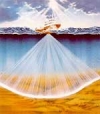
The Dutch Maasgeul is subject to very heavy shipping traffic. For guarantying this traffic’s safe passage, up-to-date and accurate information on the water depths is of utmost importance. Whenever the water depth drops below specified values, dredging operations are executed. For ensuring dredging to be done timely (safety), but not too often (costs), regular measurements of the water depths are carried out by Rijkswaterstaat (RWS).
For this use is made of the multi beam echo sounder (MBES). This system has recently revolutionized the field of riverbed/seabed mapping and is gaining more and more wide-spread use. It measures the water depths (bathymetry) along a swath perpendicular to...
A. Quan Le (TU Delft, DEOS)
Galileo is a European initiative for the development of a civil and global infrastructure for positioning and navigation with satellites. The system now is in the stage of development and it is to be expected in operation in 2008. Galileo will consist of about thirty satellites in medium high orbits around the earth. The final object of Galileo is European sovereignty in the rapid expanding markets for applications of positioning, navigation and transfer of time. It is expected that the macro economic benefit of Galileo through the sale of equipment, supplies and services will be one magnitude bigger than the investments for putting up the infrastructure in...


