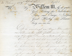
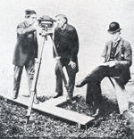
The Netherlands Geodetic Commission (Rijkscommissie voor Graadmeting en Waterpassing) was set up by Royal Decree of 20th February 1879 following an advice of the Royal Netherlands Academy of Arts and Sciences (KNAW). The Royal Decree defined the duties of the Commission as follows:
a. To continue and complete the triangulation measurements on behalf of the European Arc-measurement.
b. To continue and complete the precise levelling network.
c. To coordinate the work for those two surveys.
About 1930 a milestone was reached in the history of the Commission. Its original assignments were completed, i.e. the precise levelling in 1888, the primary triangulation in 1921 and the secondary triangulation in 1929. Te responsibility for the precise levelling had been handed over to the General Service of Rijkswaterstaat in 1888 and the updating and revision of the triangulation was turned over to the Cadastral Service in 1930.
On the 5th October 1937 a new Royal Decree was promulgated by which the 'Rijkscommissie voor Geodesie' was established. The task of the new Commission was "to continue the scientific work of the old commission and at the same time act as general coordinator of the various government services in the field of geodesy".
Because of reorganization the 'Rijkscommissie', until than under the jurisdiction of the Ministry of Education and Sciences, was placed in the organization of the KNAW (Royal Netherlands Academy of Arts and Sciences). The name of the Commission was changed than into 'Nederlandse Commissie voor Geodesie'.
See also: The Centenary of the Netherlands Geodetic Commission, edited by N. van der Schraaf, 1979.
On 2nd January 2005 the honorary member of the Netherlands Geodetic Commission Prof.Dr.Ir. Willem Baarda passed away in Delft, the Netherlands. Prof. Baarda was from 1952 up to 1996 member of the Commission and as from 1996 honorary member. From 1957 up to 1980 he was Secretary and from 1980 up to 1987 President of the Commission.
