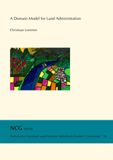
Publications on Geodesy 78
Delft, 2012. 244 pagina's. ISBN: 978 90 6132 336 5. Alleen verkrijgbaar als pdf.
Summary
A Domain Model for Land Administration is designed in this thesis. There is a need for domain specific standardisation to capture the semantics of the land administration domain on top of the agreed foundation of basic standards for geometry, temporal aspects, metadata and also observations and measurements from the field. A standard is required for communication between professionals, for system design, system development and system implementation purposes and for purposes of data exchange and data quality management. Such a standard will enable GIS and DBMS providers and/or open source communities to develop products and applications for Land Administration purposes. And in turn this will enable land registry and cadastral organisations to use the components of the standard to develop, implement and maintain systems in an even more efficient way. The research objective is to design a Land Administration Domain Model (LADM). It should be possible to use this model as a basis for Land Administration System (LAS) development. Such a LADM has to be broadly accepted and it should be adaptable to local situations. It has to be usable to organise Land Administration data within a Spatial Data Infrastructure (SDI). The design is based on the pattern of 'people - land' relationships. The model should be as simple as possible, it should cover the basic data related components of Land Administration (legal/administrative, mapping and surveying) and it should satisfy user requirements. The Domain Model in its implementation is can be distributed over different organisations with different tasks and responsibilities.
This research does not focus on the legal, political, economic, institutional or financial aspects of Land Administration and Land Administration organisations; at least as far as those are not related to user requirements for the model. Taxation, valuation and land use are knowledge fields in itself and are not within the focus of this thesis.
Chapter 1 gives an introduction to the subject of this research. Motivation and background, research objectives and questions, the methodology and the scope and limits are presented. Chapter 2, a review of existing work in LA Modelling, provides the results of a literature review on people to land relationships from modelling and land policy perspectives and comprises a discussion on common patterns in this relationship. The core of the thesis is in Chapter 3: the design and construction of the land administration domain model. Three main versions (A, B and C) are introduced with evolving and more and more refined user requirements included. In Chapter 4 experimental results are presented from prototype software. Implementations: first Examples of LADM are discussed in relation to international attention in several countries and within the INSPIRE and the (agricultural) Land Parcel Identification System of the European Union development in Chapter 5. Chapter 6 gives an overview of conclusions and future work.
The design of the LADM took place in an incremental approach. For the presented Versions A and B this concerns input from workshops, personal experience, other expertise and improvements from reviews of publications and for the Version C of the LADM the development process for International Standards. After preparatory works of almost six years the LADM has been submitted to the ISO and parallel to CEN. After positive results of voting on the so-called New Working Item Proposal (NWIP) in May 2008 and on the Committee Draft (CD) in October 2009 the Draft International Standard (DIS) received a positive vote in June 2011; the International Standard is expected in August 2012. The Draft International Standard is called LADM Version C in this thesis. The developments in ISO are a comprehensive, extensive, formal process with a continuous review and a continuous, creative approach to find common denominators in land administration systems, including data sets. Many comments and observations have been processed to bring the LADM to the required quality level needed for international acceptance.
The Draft International Standard, published by ISO as ISO 19152, covers basic information related to components of land administration (including water and elements above and below the earth's surface). It includes agreements on data about administrative and spatial units, land rights in a broad sense and source documents (e.g. deeds or surveys). The rights may include real and personal, formal rights as well as indigenous, customary and informal rights. All types of restrictions and responsibilities can be represented. The draft standard can be extended and adapted to local situations; in this way all people – land relationships may be represented.
The three main packages of the LADM consist of the Party package, the Administrative package and the Spatial Unit package.
The main class of the party package of LADM is class LA_Party with its specialisation LA_GroupParty. There is an optional association class LA_Party- Member. A Party is a person or organisation that plays a role in a rights transaction. An organisation can be a company, a municipality, the state, or a church community. A 'group party' is any number of parties, forming together a distinct entity. A 'party member' is a party registered and identified as a constituent of a group party. This allows documentation of information to membership.
The administrative package concerns the abstract class LA_RRR (with its three concrete subclasses LA_Right, LA_Restriction and LA_Responsibility), and class LA_BAUnit (Basic Administrative Unit). A 'right' is an action, activity or class of actions that a system participant may perform on or using an associated resource. Examples are: ownership right, tenancy right, possession, customary right or an informal right. A right can be an (informal) use right. Rights may be overlapping or may be in disagreement. A 'restriction' is a formal or informal entitlement to refrain from doing something; e.g. it is not allowed to build within 200 meters of a fuel station; or a servitude or a mortgage as a restriction to the ownership right. A 'responsibility' is a formal or informal obligation to do something; e.g. the responsibility to clean a ditch, to keep a snow-free pavement or to remove icicles from the roof during winter or to maintain a monument. A 'baunit' (an abbreviation for 'basic administrative unit') is an administrative entity consisting of zero or more spatial units (parcels) against which one or more unique and homogeneous rights (e.g. an ownership right or a land use right), responsibilities or restrictions are associated to the whole entity as included in the Land Administration System. An example of a 'baunit' is a basic property unit with two spatial units (e.g. an apartment or a garage). A 'basic administrative unit' may play the role of a 'party' because it may hold a right of easement over another, usually neighboring, spatial unit.
The spatial unit package concerns the classes LA_SpatialUnit, LA_SpatialUnitGroup, LA_Level, LA_LegalSpaceNetwork, LA_LegalSpace- BuildingUnit and LA_RequiredRelationshipSpatialUnit. A 'spatial unit' can be represented as a text ("from this tree to that river"), a point (or multi-point), a line (or multi-line), representing a single area (or multiple areas) of land (or water) or, more specifically, a single volume of space (or multiple volumes of space). Single areas are the general case and multiple areas the exception. Spatial units are structured in a way to support the creation and management of basic administrative units. A 'spatial unit group' is a group of spatial units; e.g.: spatial units within an administrative zone (e.g. a section, a canton, a municipality, a department, a province or a country) or within a planning area. A 'level' is a collection of spatial units with a geometric and/or topologic and/or thematic coherence. The Spatial Unit Package has one Surveying and Spatial Representation Subpackage with classes such as LA_SpatialSource, LA_Point, LA_BoundaryFaceString and LA_BoundaryFace. Points can be acquired in the field by classical surveys or with images. A survey is documented with spatial sources. A set of measurements with observations (distances, bearings, etc.) of points, is an attribute of LA_SpatialSource. The individual points are instances of class LA_Point, which is associated to LA_SpatialSource. 2D and 3D representations of spatial units use boundary face string (2D boundaries implying vertical faces forming a part of the outside of a spatial unit) and boundary faces (faces used in 3D representation of a boundary of a spatial unit). Co-ordinates themselves either come from points or are captured as linear geometry.
Implementation of the LADM can be performed in a flexible way; the draft standard can be extended and adapted to local situations. External links to other databases (supporting GII type of deployment), e.g. addresses, are included. Legal implications that interfere with (national) land administration laws are outside the scope of the LADM.
The objective of this research has been achieved; the research questions have been answered. Validation has been performed. The fact that many experts have been involved in the LADM development - with a lot of experience in developments and implementations of LASs - is a solid basis. Their acceptance is very promising. Also developments in Cyprus and with FLOSS SOLA, an OpenSource Software development at the Food and Agricultural Organisation and the development of the Social Tenure Domain Model (a LADM specialisation) at UN-HABITAT are promising. Relevant is the attention of commercial software suppliers to the LADM development. There are proposals for implementation of the LADM in several countries already, even before it has been published as an International Standard. More testing is required. Data exchange requires further attention in testing of the LADM.
Future work in relation to the LADM can be the development and inclusion of New RRRs, 3D and 4D Cadastre, linking into augmented reality applications, support in spatial design and support in monitoring spatial changes worldwide. Further standardisation (other domains and processes) and LADM maintenance is important, especially for the development of mature information infrastructures.
Table of contents
- Preface ... v
- Acknowledgements ... vii
- Table of Contents ... ix
- Introduction ... 1
- A Review of Existing Work on LA Domain Modelling ... 23
- Design and Construction of an Land Administration Domain Model ... 55
- New Approaches and Experimental Results ... 131
- Implementations: First Results ... 151
- Conclusions and Recommendations ... 175
- References ... 185
- Appendix A. LADM Class Names ... 211
- Appendix B. LADM Associations between Classes in the DIS ... 213
- Appendix C. Instance Level Diagrams ... 215
- Appendix D. Terms and Definitions used in the DIS ... 221
- Abbreviations ... 223
- Summary ... 225
- Samenvatting ... 229
- Curriculum Vitae ... 233
Samenvatting
Een Domein Model voor Land Administratie
In dit proefschrift is een Domein Model voor Land Administratie ontworpen. 'Land Administratie' kan gezien worden als Kadaster 'in ruime zin'. Er is behoefte aan domein specifieke standaardisatie om de semantiek van Land Administratie vast te leggen op basis van al bestaande standaarden voor geometrie, tijd, metadata en voor waarnemingen en metingen uit het veld. Een standaard is nodig voor communicatie doeleiden, voor systeemontwerp, voor systeemontwikkeling, voor systeemimplementatie en ook voor uitwisseling van gegevens in de Land Administratie. Leveranciers van GIS en DBMS software en/of open source gemeenschappen worden zo in staat gesteld om op een relatief eenvoudige manier producten en toepassingen te ontwikkelen voor toepassing in de Land Administratie. En, op zijn beurt, zal het landregistratie- en kadasterorganisaties in staat stellen om de componenten van de standaard te gebruiken om systemen op een nog efficientere wijze te ontwikkelen, te implementeren en te onderhouden. De onderzoeksdoelstelling is het ontwerpen van een Land Administratie Domein Model (LADM). Om een dergelijk LADM breed geaccepteerd te krijgen moet het aan te passen zijn aan lokale omstandigheden. En het moet bruikbaar zijn om Land Administratie gegevens in te passen in zgn. ruimtelijke informatie infrastructuren. Het model is gebaseerd op het patroon van relaties tussen mensen en land. Er is steeds getracht het model zo simpel als mogelijk te houden, en het moet de basisgegevens gerelateerde componenten van Land Administratie bevatten (wettelijk/administratieve, landmeetkundige en topologische) en het moet voldoen aan eisen van gebruikers. Verondersteld wordt dat het Domein Model over meerdere organisaties wordt geimplementeerd, waarbij iedere organisatie een eigen verantwoordelijkheid in de Land Administratie heeft.
Dit onderzoek richt zich niet op wettelijke, politieke, economische, institutionele of financiële aspecten van Land Administratie en Land Administratie organisaties, tenminste voor zover deze niet gekoppeld zijn aan de gebruikerseisen voor het model. Belastingheffing, waardebepaling en landgebruik zijn kennisvelden op zichzelf en vallen niet in het aandachtsgebied van deze dissertatie.
Hoofdstuk 1 geeft een inleiding op het onderwerp van dit onderzoek. Motivatie en achtergrond, onderzoeksdoelstellingen en vragen, de methodologie, de focus en beperkingen worden gepresenteerd. Hoofdstuk 2, geeft de resultaten van een literatuurstudie over relaties tussen mensen en grond vanuit het perspectief van modellering en het omvat een discussie over hat algemene patroon in deze relatie. De kern van de dissertatie is Hoofdstuk 3: 'het ontwerp en de bouw van het Land Administratie Domein Model'. Drie hoofdversies (A, B en C) worden geintroduceerd op basis van gebruikerseisen. In Hoofdstuk 4 worden de experimentele resultaten gepresenteerd van een prototype. Implementatievoorbeelden worden besproken in Hoofdstuk 5 in de context van internationale aandacht voor het model: vanuit verschillende landen, vanuit ontwikkelingen in INSPIRE en ook vanuit het Land Perceel Identificatie Systeem van de Europese Unie. Hoofdstuk 6 geeft een overzicht van conclusies en mogelijk toekomstig werk.
Het LADM is stapsgewijs ontworpen. Ten behoeve van de gepresenteerde versies A en B gaat het om inbreng vanuit literatuurstudies, workshops en om verbeteringen op basis van beoordelingen van publicaties. Bij versie C staat de ontwikkeling van een Internationale Standaard centraal. Na voorbereidend werk gedurende ongeveer zes jaar is het LADM aan de Internationale Organisatie voor Standaardisatie voorgelegd. Na een positief resultaat van een de stemming van een 'New Working Item Proposal' in mei 2008 en ook van de 'Committee Draft' in oktober 2009 kreeg de 'Draft Internationale Standaard' (DIS) een positieve beoordeling tijdens de stemming in juni 2011; de Internationale Standaard wordt verwacht in juli 2012. De 'Draft International Standard' wordt in deze dissertatie LADM Versie C genoemd. De ontwikkelingen binnen de ISO betreffen een veelomvattend, intensief, formeel proces met continue beoordelingen en een continue creatieve aanpakom de grootste gemene deler in land administratie systemen te vinden, inclusief gegevensbestanden. Heel veel commentaren en waarnemingen zijn verwerkt om het LADM op het vereiste kwaliteitsniveau voor internationale acceptatie te brengen.
De 'Draft International Standard', gepubliceerd door ISO als ISO 19152, betreft de basisinformatie gekoppeld aan componenten van Land Administratie (inclusief water en elementen boven en onder het aardoppervlak). Deze basisinformatie omvat overeenkomsten over administratieve en ruimtelijke eenheden, landrechten in de brede zin van het woord, alsook inheemse, gewoonte- en informele rechten. Alle typen beperkingen en verantwoordelijkheden kunnen worden afgebeeld. Overlappende aanspraken kunnen worden opgenomen. De 'Draft International Standard' kan worden uitgebreid naar en aangepast op lokale situaties; op deze wijze kunnen alle mens - landrelaties worden afgebeeld in het model.
De belangrijkste klasse uit het 'party package' van het LADM is de klasse 'LA_Party' met de specialisatie 'LA_GroupParty'. Er is een optionele associatieklasse 'LA_PartyMember'. Een 'party' is een persoon of organisatie die een rol speelt in de transactie in rechten. Een organisatie kan bij voorbeeld een bedrijf zijn of een gemeente, een cooperatie, of een Staat. Een 'group party is een aantal '' parties', die samen een afzonderlijke eenheid vormt. Een 'partymember' is een 'party' die geregistreerd en geïdentificeerd is als een deel van de 'group party'. Dit staat documentatie van gegevens van leden van een groep toe.
Het 'administrative package' betreft de abstracte klasse 'LA_RRR' (met drie concrete subklassen 'LA_Right', 'LA_Restriction' en 'LA_Responsibility') en de klasse 'BAUnit' ('basis administratieve eenheid'). Een 'right' is een actie, activiteit of categorie van handelingen, die een systeemdeelnemer kan uitvoeren op of met behulp van een bijbehorende hulpbron. Voorbeelden zijn: eigendomsrecht, pachtrecht, bezit, gewoonterecht of een informeel recht. Een 'right' kan een (informeel) gebruiksrecht zijn. 'Rights' kunnen overlappend zijn of er kan overeenstemming ontbreken. Een 'restriction' is een formeel of informeel recht om iets te doen of zich te onthouden om iets te doen, bijvoorbeeld het is niet toegestaan om binnen een afstand van 200 meter van een benzinestation te bouwen of een erfdienstbaarheid of een hypotheek als beperking op een eigendomsrecht. Een 'responsibility' is een formele of informele verplichting om iets te doen, bijvoorbeeld om een sloot schoon te maken of om een pad sneeuw vrij te houden of om een monument te onderhouden. Een 'baunit' is een basis administratieve eenheid bestaande uit nul of meer 'spatial units' (percelen), waarmee een of meer unieke en homogene 'rights' (bijvoorbeeld een eigendomsrecht en een gebruiksrecht) en/of 'restrictions' en/of 'responsibilities' zijn geassocieerd. Een voorbeeld van een 'baunit' is een eigendomseenheid met twee 'spatial units' (bijvoorbeeld een appartement en een garage). Een 'baunit' kan een 'party' zijn, omdat een 'baunit' een erfdienstbaarheid kan houden over een andere, meestal aangrenzende, 'spatial unit'.
Het 'spatial unit package' betreft de klasses 'LA_SpatialUnit', 'LA_SpatialUnitGroup', 'LA_Level', 'LA_LegalSpaceNetwork', 'LA_LegalSpace- BuildingUnit' en 'LA_RequiredRelationshipSpatialUnit'. Een 'spatial unit' kan worden weergegeven als een tekst ("van deze boom tot die rivier"), een punt (of meerdere punten), een lijn (of een verzameling van lijnen), die een vlak (of meerdere vlakken) land (of water) of, meer specifiek, een volume ruimte (of meerdere volumes ruimte, ondergronds/bovengronds) afbeelden. 'Spatial units' zijn gestructureerd op een wijze, die de creatie en het management van 'baunits' mogelijk maakt. 'Spatial units' betreffen een flexibel concept om de werkelijkheid weer te geven. Een 'spatial unit group' is een groep 'spatial units', bijvoorbeeld alle 'spatial units' binnen een administratieve zone (een sectie, een canton, een gemeente, een departement, een provincie of een land) of binnen een planning gebied. Een 'level' is een verzameling 'spatial units' met een geometrische, topologische of thematische samenhang. Het 'spatial unit package' heeft een 'surveying and spatial representation subpackage' met klasses zoals 'LA_SpatialSource', 'LA_Point', 'LA_BoundaryFaceString' en 'LA_BoundaryFace'. 'Points' kunnen worden ingewonnen in het veld met landmeetkundige metingen of met behulp van satellietbeelden of luchtfoto's. Een meting wordt gedocumenteerd met 'spatial sources'. Een verzameling landmeetkundige waarnemingen (afstanden, richtingen, etc.) is een attribuut van 'LA_SpatialSource'. De individuele 'points' zijn instanties van de klasse 'LA_Point', die geassocieerd is met 'LA_SpatialSource'. 2D en 3D weergaves van ruimtelijke eenheden gebruiken 'boundary face strings' (2D grenzen die een verticaal aanzicht impliceren dat een deel van de buitenkant van de ruimtelijke eenheid vormt) en 'boundary faces' (aanzichten gebruikt in 3D weergave van een grens van een ruimtelijke eenheid). Coordinaten zelf komen ofwel van punten ofwel als lineaire geometrie.
Implementatie van het LADM kan op een flexibele wijze worden uitgevoerd; de Draft International Standard kan worden uitgebreid naar en aangepast waar dat nodig is. Exerne koppelingen met andere gegevensbestanden, bijvoorbeeld adressen, zijn opgenomen. Juridische implicaties, die interfereren met nationale wetgeving op het gebied van Land Administratie, vallen buiten het bereik van het LADM.
De doelstelling van dit onderzoek is bereikt; de onderzoeksvragen zijn beantwoord. Validatie is uitgevoerd. Er is een groot aantal experts, met veel ervaring in de ontwikkeling van Land Administratie Systemen, betrokken geweest in de LADM-ontwikkeling. Hun acceptatie van het model is veelzeggend en veelbelovend. Ook ontwikkelingen in Cyprus en met FLOSS/SOLA, een open source software ontwikkeling bij de FAO, evenals de ontwikkeling van het STDM bij UN-HABITAT stemmen hoopvol. Relevant is ook de aandacht van commerciële softwareontwikkelaars voor het LADM. Er bestaan al voorstellen voor de implementatie van het LADM in verschillende landen, zodra deze gepubliceerd is als een Internationale Standaard. Meer testen zijn noodzakelijk, vooral op het gebied van gegevensuitwisseling.
Toekomstig werk in relatie tot het LADM kan de ontwikkeling en inrichting van nieuwe RRRs ('rechten', 'beperkingen' en 'verantwoordelijkheden') noodzakelijk maken. Te denken valt aan 3D en 4D Kadaster, koppeling met applicaties voor 'augmented reality', ondersteuning bij ruimtelijk ontwerp, ontwikkeling naar semantisch web technologie en ondersteuning bij het controleren van ruimtelijke veranderingen wereldwijd. De invloed van gebruikers zal in toenemende mate relevant worden. Verdere standaardisatie (op andere domeinen) en onderhoud van het LADM zijn belangrijk, vooral in verband met de ontwikkeling van volwassen ruimtelijke infrastructuren.
