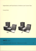
George Sithole
Publications on Geodesy 59, Delft, 2005. 204 pagina's.
ISBN-13: 978 90 6132 292 4. ISBN-10: 90 6132 292 8.
Summary
Various methods have been developed to measure the physical presence of objects in a landscape with high positional accuracy. A new method that has been gaining popularity is Airborne Laser Scanning (ALS). ALS works by scanning a landscape (the collection of ground, buildings, vegetation, etc.,) in multiple passes. In each scan pulses of laser light are emitted from an airborne platform and their return time is measured, thus enabling the range from the point of emission to the landscape to be determined. The product of airborne laser scanning is a cloud of points in 3D space. ALS is capable of delivering very dense and accurate point clouds of a landscape in a relatively short time. However, in spite of the ability to measure objects with high positional accuracy, the automatic detection and interpretation of individual objects in landscapes remains a challenge. An example of just such a challenge is the classification of point clouds produced by ALS. The classification of ALS point clouds consists firstly in the labeling of points as either object or bare earth. The labeled object points are then further labeled as either building or vegetation. As a measurement technique ALS holds great promise and motivated by the desire to promote it, research has been conducted here to automate the detection of bare earth, buildings and vegetation in ALS point clouds.
Several algorithms have been developed to automatically detect the bare earth (the topsoil or any thin layering covering it) in ALS point clouds. They are generally referred to in the ALS community as filtering algorithms. An experimental study (conducted as part of this research) of filtering algorithms determined that in flat and uncomplicated landscapes (i.e., small to medium sized buildings standing well off a fairly flat ground) algorithms tend to do well. Significant differences in accuracies of filtering appear in landscapes containing steep slopes and discontinuities.
These differences are a result of the ability of algorithms to preserve discontinuities while detecting large objects. A solution for this problem was determined to lie in the segmentation of ALS point clouds. If segmentation can be achieved in such a manner that all bare earth points are gathered into the same surface segment and the points from each object are gathered into their own surface segments, then filtering can be done on the basis of surfaces rather then points. This should offer a more reliable classification since topological information can be used in addition to geometric information to classify surface segments. On the strength of the study a new segmentation based filtering algorithm was developed.
For the developed filtering algorithm a new segmentation algorithm was devised. The algorithm works by first slicing a point cloud into contiguous and parallel vertical profiles. This slicing is done in several directions. After the slicing the points in the profiles are segmented based on proximity. The segmentation of profiles yields line segments. Next, the line segments are linked together through their common points to obtain surface segments. The adjacencies of line segments in profiles are aggregated to determine the adjacency of surface segments (including overlapping surfaces). The adjacency of surface segments provides contextual information. This contextual information is used to associated particular spatial arrangement of surfaces with objects or the bare earth.
The new segmentation algorithm also has the advantage that it facilitates the detection of bridges. The experimental study also identified the ability to detect bridges as one means to improve the accuracy of filtering. Using the developed segmentation algorithm a novel bridge detection algorithm was developed. Line segments are essentially cross sections of surface segments. In the bare earth line segments that are above adjacent line segments (in the same profile) are potentially from bridges. Therefore, points that lie at the intersection of such line segments are also potentially from bridges. In this manner seed bridge points are identified. These seed points are then used to detect bridges. The algorithm has the advantage that it is able to readily detect curved bridges, bridges that do not have parallel sides and bridges that branch into parts.
The classification of buildings and vegetation uses geometric and radiometric characteristics determined for surface segments. A point cloud consisting of object points is segmented by the proximity of points. The n geometric and radiometric characteristics of surface segments are mapped into an n-dimensional feature space. Using a supervised classification the surface segments are classified as either building or vegetation.
The new algorithms were tested on real data and showed improvement over current algorithms, particularly in complex urban landscapes. It is envisaged that with the inclusion of external data, e.g., thematic maps, existing digital elevation models and infra red imagery, the classification accuracy of ALS point clouds can be further improved.
Contents
- Introduction
- ALS and Filtering Algorithms
- ISPRS Filter Test
- Filter Design
- Segmentation
- Classification
- Results and Quality Analysis
- Conclusion and future work
- Bibliography
- Analysis of point and segment attributes
- Algorithm Parameters
- ISPRS Filter Test Results
- Example of macro object and bridge detection
Samenvatting
Voor het vastleggen van de geometrie van een landschap - een deel van de aarde en alles wat zich daarop bevindt - is de populariteit van Airborne Laser Scanning (ALS) de laatste jaren sterk toegenomen. Met ALS wordt een landschap in stroken afgetast, waarbij korte pulsen laserlicht worden uitgezonden vanaf een vliegend platform. Het gereflecteerde signaal wordt opgevangen en de richting en looptijd van de puls worden gemeten. Hieruit wordt de afstand naar en de positie van een punt in het landschap afgeleid. Daarmee resulteert ALS in een 3D puntenwolk van hoge dichtheid en precisie die in een relatief korte tijd verkregen wordt. Automatische detectie en interpretatie van individuele objecten in het landschap - nodig vanwege de arbeidsintensieve handmatige verwerking van de grote hoeveelheden gegevens - vormt een grote uitdaging. Een voorbeeld van een dergelijke uitdaging is de classificatie van met ALS geproduceerde puntenwolken. Deze classificatie bestaat uit twee stappen: eerst worden de objecten gedetecteerd die zich op de aarde bevinden, dan worden deze objecten onderverdeeld in gebouwen en vegetatie. Het automatisch onderscheiden van gebouwen, vegetatie en de aarde waar zich deze objecten op bevinden is het onderwerp van het onderzoek dat in dit proefschrift beschreven wordt.
Vele algoritmen zijn ontwikkeld om de kale aarde - de aarde zonder gebouwen of vegetatie - uit een ALS-puntenwolk te extraheren, een taak die in de ALS-gemeenschap beter bekend staat als filteren. Een studie naar acht filteralgoritmen is uitgevoerd als onderdeel van het onderzoek met als doel het kwalificeren van de prestaties van deze algoritmen en het inventariseren van de aanwezige problemen bij het onderscheiden van objecten en kale aarde in een landschap. De test toonde aan dat in vlakke en eenvoudige landschappen (zoals kleine tot middelgrote gebouwen in een nagenoeg vlak terrein) alle algoritmen voldeden. Significante verschillen deden zich voor bij landschappen met steile hellingen en discontinuïteiten in het terrein. De oorzaak lag in het uiteenlopende vermogen van de algoritmen om de discontinuïteiten in stand te houden bij het detecteren van grote objecten. Segmentatie van de ALS-puntenwolken is de oplossing voor dit probleem. Filtering kan gedaan worden op basis van vlakken in plaats van punten wanneer zodanig gesegmenteerd kan worden dat alle kale-aarde-punten verzameld worden in n vlaksegment en de punten van een bepaald object in een ander vlaksegment. Deze aanpak maakt een betrouwbaardere classificatie mogelijk omdat naast geometrische informatie ook topologische informatie gebruikt wordt. Daarom werd een nieuw filteralgoritme ontworpen gebaseerd op segmentatie om de problemen die zich voordeden in de genoemde studie te overwinnen.
Een nieuw segmentatiealgoritme vormt de basis voor het ontwikkelde filteralgoritme. Daarbij wordt de puntenwolk eerst in aaneensluitende parallelle profielen verdeeld en de punten gesegmenteerd op basis van nabijheid zodat lijnsegmenten ontstaan. Dit wordt herhaald voor verschillende windrichtingen waarna vlaksegmenten gecreëerd worden door verschillend gerichte lijnsegmenten te combineren op basis van gemeenschappelijke punten. De nabijheid van lijnsegmenten in de profielen wordt vervolgens gebruikt voor het classificeren van de vorm van de vlaksegmenten. Deze vorm van de vlaksegmenten wordt dan weer gebruikt voor het classificeren van de vlaksegmenten als kale aarde of object.
Een voordeel van het nieuwe segmentatiealgoritme is dat het de detectie van bruggen mogelijk maakt. De eerder genoemde studie toonde aan dat filteralgoritmen significant verbeteren met de mogelijkheid bruggen te detecteren. Het ontwikkelde algoritme voor de detectie van bruggen kan als volgt geschetst worden. Punten in lijnsegmenten die hoger liggen dan naburige lijnsegmenten (in hetzelfde profiel) behoren mogelijk tot een brug. Behoort een dergelijk punt ook tot een kruisend lijnsegment met dezelfde eigenschap, dan wordt dit punt gebruikt als startpunt voor de brugdetectie. Het algoritme is in staat om gekromde bruggen te detecteren, bruggen zonder parallelle begrenzingen of bruggen die zich splitsen.
Het algoritme voor het onderscheiden van gebouwen en vegetatie maakt gebruik van een feature-based approach. Daarbij wordt een puntenwolk eerst gesegmenteerd op basis van de nabijheid van de punten. Vervolgens vormen n geometrische en radiometrische eigenschappen de n-dimensionale kenmerkenruimte (de zogenaamde feature space). Deze wordt gebruikt om met behulp van een supervised classification gebouwen en vegetatie te onderscheiden.
De nieuwe algoritmen zijn getest op echte data en lieten verbeteringen zien ten opzichte van bestaande algoritmen, met name in complexe stedelijke gebieden. Het is te verwachten dat met de toevoeging van externe gegevens (zoals thematische kaarten, bestaande digitale hoogtemodellen of infraroodbeelden) en het gebruik van ALS-gegevens waarbij de golfvorm van de gereflecteerde straling wordt geregistreerd, de nauwkeurigheid van de classificatie van ALS-puntenwolken verder zal verbeteren.
