
")
")


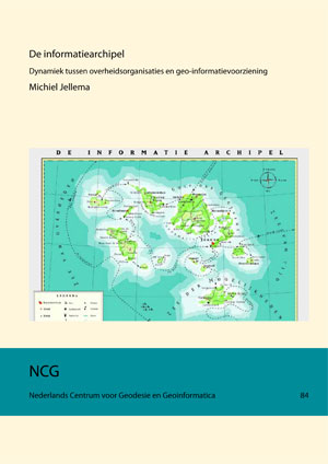
Dynamics between government organisations and geo-information provision
Michiel Jellema (This email address is being protected from spambots. You need JavaScript enabled to view it.)
Publications on Geodesy 84
2014, 360 pages. ISBN (print): 978-90-5199-532-9. ISBN (online): 978-90-5199-533-6.
Summary
Introduction
The Information Archipelago, the title of this study, is a group of islands which provides knowledge or insight. This group of islands – in this study – represent the society and several islands are government organisations. Each island develops itself and an island-specific geo-information function takes care of day-to-day business. A national geo-information infrastructure connects the government organisation islands at least to each other and is able to supply knowledge and insight on the island-specific geo-information. In this way supply and demand of geo-information is facilitated among various islands.
The previous metaphor typifies the domain of this study and everyday practice shows slow progress in the development of the national geo-information infrastructure. Not only on a national but also on a global level its practical realisation seems a very complex and persevering subject. The interaction between supply and demand of geo-information is improving over time (Besemer, 2005).
It is not surprising that the Dutch government regards the geo-information function in the Netherlands as an important topic because of its large social and economical significance. On a daily basis a large number of government organisations uses geo-information for many diverse applications and in many operational processes. Because of the interrelationship between the operational processes of various government organisations and through the partially generic applicability of the geo-databases as developed by the individual government organisations, government organisations for the geo-information function largely depend upon each other and therefore cooperation is obvious (Grothe, 1996).
Problem definition
Cooperation between government organisations is expected to lead to positive results in case the effect of the national geo-information infrastructure will lead to a qualitative and/or quantitative support of the operational processes and the corresponding geo-information function of each individual government organisation. In line with this reasoning the development of the national geoinformation infrastructure is also dependent upon the development of the directly involved
government organisations.
This is an important presumption of this study. It is expected that the possibility of achieving benefits for society derived from the national geo-information infrastructure is larger when – over a certain period of time – the organisational development targets of the government organisations actively involved in the operational processes of the geo-information infrastructure, align with the development targets of the national geo-information infrastructure.
The previous leads to the following problem definition as applied in this study:
Is it possible that the presumed dynamics which exist between the development of government organisations actively involved in the operational processes of the geo-information and the nation geo-information function can be explained based on a model, and can this model be used to improve the alignment between the further development of the national geo-information function and the development of these directly involved government organisations in the future?
This problem definition is split into the following research questions:
- Can organisational developments at government organisations be explained with an organisational model?
- How does the organisational model deal with the subject of 'geo-information function' and what development is presumed?
- How did the government organisations, as selected for this study, develop over the past decades?
- What targets formed the basis of these organisational developments?
- Can the alignment of the selected government organisations to the national geo-information function be explained with the organisational model?
- Can the organisational model be used to improve the alignment between the further development of the national geo-information function and the development of these directly involved government organisations in the future?
Method
As described previously, in this study a model has been developed, based on the presumed dynamics between the development of government organisations and the national geo-information function, which explains the presumed dynamics and also directs future developments.
To explain this an analysis of the theoretical framework was made with the objective to model the presumed dynamics. Initially, the geo-information function was described as the Geo-ICT function. In the Geo-ICT function distinction was made between the Geo-ICT infrastructure and the innovations in the domain of Geo-ICT.
Next, a quick scan was conducted on organisation theories suitable for this study, which included or connected to the following five principles:
- Organisations continuously evolve and are in various stages of development.
- The organisation theory explains the effects of interventions in the organisational development and also directs future development.
- A connection to the ICT function can be made from within the organisational development.
- Application of the organisation theory within government organisations is possible.
- The organisation theory concentrates on management questions.
The quick scan lead to making a connection with the organisation theories which formed the basis for the Four-Phase Model (Hardjono, 1999). To strengthen the crucial relation with the ICT function these organisation theories were complemented by applying the Strategic Alignment Model of Henderson & Venkatraman (1999).
In order to describe the presumed dynamics the modelling took place based on the applied organisation theories. Before presenting the result of this modelling some comments on the application of organisation theories and the models to be derived should be kept in mind:
- Based on the implemented orientation on the organisation theories and the models derived, it is stated that no single organisation theory is fully comprehensive and that the model as derived from an organisation theory is limited by this.
- Models derived from organisation theories have in practice been applied through the years with varying success. These management models are no objects in their own right, but a medium which can be applied to a certain strategic management question. This applies, similar to the statement of a chef-de-cuisine that "a recipe is only an instruction" to management models (Ten Have et al., 2007).
- Finally one should be aware of the fact that with the application of management models the interpretation of strategic development is neglected. The guiding motto of the philosopher Whitehead is noted: "Seek simplicity and distrust it."
A properly reflected application of organisation theories from the spectrum of commercial enterprises onto government organisations should clearly acknowledge the environment to which the management of government organisations is exposed. With regard to the subject of this study and the fact that it involves a management question it is assumed that these differences have little influence on this study. Organisation theories from the spectrum of commercial enterprises can therefore be applied to government organisations.
The development of the model took place in accordance with the previous stated observations and the result is the descriptive Strategic Position Model Geo-ICT function. The alignment, essential to this study, was established between the dynamics in the organisational development of government organisations, in the Geo-ICT function and in extension to the national Geo-ICT function (see Figure I).
 Figure I Strategic Position Model Geo-ICT function
Also, the Strategic Position Model Geo-ICT function was connected with the Open Hierarchical Model of Geo-information Infrastructures and was made applicable to all government organisations, regardless of the management level or the hierarchical position of the organisation (Jellema, 2010).
With this descriptive model it is theoretically feasible to interpret, explain and direct future development of the dynamics between the development of government organisations and the development of the national geo-information function. For the necessary practical validation test of the Strategic Position Model Geo-ICT function the research method and research form was defined.
The validation of the Strategic Position Model Geo-ICT function was executed as a multiple case study, based on qualitative historical research.
The multiple case study comprised four cases in total. For the validity testing of the Strategic Position Model Geo-ICT function the municipalities of Almere and Doetinchem and the Kadaster were studied together with the national Geo-ICT function. Only by analyzing this fourth case, it was possible to answer the research questions. In Figure II the four cases are positioned in the Open Hierarchical Model of Geo-information Infrastructures (Jellema, 2010).
 Figure II Positioning of the four cases
The validation tests of the Strategic Position Model Geo-ICT function led to a positive result, which means that the model proved to be valid and applicable in practice.
Observations
A number of observations have been made during the development and validation of the Strategic Position Model Geo-ICT function. These observations relate to the context, the problem definition and the result of this study.
Testing the five principles
The five aforementioned principles were considered with the theoretical analysis of the applicable organisation theories. For each principle an answer was given to the question to what extent the application of the Strategic Position Model Geo-ICT function links to these principles in practice.
- Organisations continuously evolve and are in various stages of development
The application of the Strategic Position Model Geo-ICT function to all four cases led to the perception that a continuous development is observed, both in the organisation and the (national) Geo-ICT function. A consequence of this continuous development and the related different speeds is among others that the government organisations are very often sub-optimally aligned to the (national) Geo-ICT function. A suboptimal alignment is in this respect defined as a connection between two different management orientations. - The organisation theory explains interventions in the organisational development and also directs future developments
The Strategic Position Model Geo-ICT function explains and defines the interventions in the development of the organisation and the (national) Geo-ICT function. It also delivers enough diverse perception to explain and position the intervention. The direction for future developments is being perceived by the application of the Strategic Position Model Geo-ICT function both by positioning each individually analysed intervention as well as by positioning the combined analysed interventions in a time frame. - A connection with the ICT function can be made from within the organisational development
Applying the Strategic Position Model Geo-ICT function in the various cases shows that based on the analysis of the different moments of intervention it is possible to identify a relation between the development of organisations and the (national) Geo-ICT function. This relation can be established both from within the organisational development and from the development of the (national) Geo-ICT function. Furthermore, it is possible to establish a relation between the different Geo-ICT functions which are contained in the Open Hierarchical Model of Geoinformation Infrastructures (Jellema, 2010). - Application of the organisation theory within government organisations is possible
During the study there were no indications that the Strategic Position Model Geo-ICT function is not, to a lesser extent or only partially, applicable to the four cases, taking into account the described context of organisation theories and the constituting differences between government organisations and commercial enterprises. Thus, the constituting differences between government organisations and commercial enterprises have little influence on the management questions of organisation development. Development of the Geo-ICT function and organisation theories from the spectrum of commercial enterprises could support this study and turned out to be are applicable to government organisations. - The organisation theory concentrates on management questions
The Strategic Position Model Geo-ICT function primarily aims at the questions of organisational development and development of the (national) Geo-ICT function. The framework in which this takes place is, in this study, limited to the top management of government organisations with a management term of usually three to five years. Especially this limitation makes it possible that organisation theories from the spectrum of commercial enterprises can be applied to government organisations if the organisation theories are adapted to their objectives and principles.
Optimal alignment and social significance
Through the validation test of the Strategic Position Model Geo-ICT function the way the government organisations aligned to the national Geo-ICT function – and vice versa – became evident. It became clear that the alignments between the organisational development, the individual Geo-ICT function and the national Geo-ICT function differ per organisation and are dynamic by nature. The cyclical dynamics as evidenced are different both in speed and in management orientation. During the study the alignments between the organisation(s) and the national Geo-ICT function were often and for a long term different, as caused by diverse management orientations. Therefore, the alignments were suboptimal.
The determined lack of alignment between the national Geo-ICT function and each government organisational development, assists these organisations in determining to what extent the alignment with the national Geo-ICT function has been optimal for its organisational development and the corresponding (internal) Geo-ICT function.
From the point of view of the national Geo-ICT function the explanation of the alignments with the government organisations involved gives an explanation to what extent these alignments between the national Geo-ICT function and the government organisations involved have been optimal.
The determined extent to which these alignments have been optimal can be applied to measure the social significance of an intervention within the framework of the national Geo-ICT function. The social significance was defined here as the relation between the intended or achieved social effect and the investment made (Deuten & De Kam, 2007).
Recommendations
All research questions have been answered and the main question as raised in the problem definition has been answered positively. Based on these answers and more in general on the results of the study four recommendations were presented.
Further horizontal and vertical development supports the robustness of the model Subsequent research to the application of the Strategic Position Model Geo-ICT function in diverse directions is desirable in order to reconfirm the validity of the model and in order to increase the robustness of the model. In respect of the diverse directions subsequent research can focus on:
- horizontal widening within each management level of the Geo-ICT function;
- vertical leveling between the other combinations of management levels, which are possible between the Geo-ICT function and the global Geo-ICT function.
Next, it can be desirable to enlarge the present aspect-analysis of the five aspects (intervention, results, organisational structure, decision making process and organisational culture) to other relevant management questions, such as leadership and organisational processes. In this respect it can also be desirable to pay attention to the influence and the ability of internalisation of the actual organisation in relation to the formal organization.
Better assessment of actual interventions in the Geo-ICT function
It is recommended to apply the Strategic Position Model Geo-ICT function in a broader perspective in the domain of the (national) geo-information function. This wider application will lead to a higher insight and recognition of the mutual cyclical dynamics between government organisations and the (national) Geo-ICT function. Next, it is expected that the social significance of actual interventions in an organisation or in the (national) Geo-ICT function can be better analysed on its mutual impact.
Based on further research the present qualitative assessment can possibly be extended with a quantitative assessment.
Proactivity will lead to a wider applicability of the model
It is recommended that further research not only will lead to a higher explanation of the extent to which the alignments have been optimal in the past – qualitatively and/or quantitatively –, but will also show at which times future interventions can be made or are desirable. This explanation might lead to an implementation strategy of the relevant interventions in the national Geo-ICT function which is optimally adjusted to the alignments with the relevant government organisations.
Applicability of the model to other ICT domains within the government
As the Geo-ICT function does not significantly differ from the overall ICT function, it is recommended to validate the model in other ICT domains within the government and will be made applicable to these other domains after an adaptability or extension to these domains. New domains will be those where government organisations show a large involvement at different management levels and with a high frequency of information exchange. Examples are health care, sustainable development and public security.