
")
")


Jeroen van den Ameele (DEOS, TU Delft)
The Dutch Maasgeul is subject to very heavy shipping traffic. For guarantying this traffic’s safe passage, up-to-date and accurate information on the water depths is of utmost importance. Whenever the water depth drops below specified values, dredging operations are executed. For ensuring dredging to be done timely (safety), but not too often (costs), regular measurements of the water depths are carried out by Rijkswaterstaat (RWS).
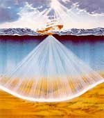
For this use is made of the multi beam echo sounder (MBES). This system has recently revolutionized the field of riverbed/seabed mapping and is gaining more and more wide-spread use. It measures the water depths (bathymetry) along a swath perpendicular to the sailing direction and thereby allows for detailed surveying with a limited amount of tracks. For precise bathymetry determination accurate information on the prevailing sound speed profile (ssp), i.e., sound speed as a function of depth, is required at the time of the measurements. The ssp is needed for correcting for the refraction effects in the water column when deriving the bathymetry from the measured travel times. The Maasgeul is a highly dynamic environment where the water temperature and salinity (and consequently sound speed) are changing rapidly. Therefore, ideally, ssp measurements need to be taken continuously during the survey. However, for accurate ssp measurements, the ship has to be stationary which is costly and time-consuming. As a result, in practice, only a limited amount of these ssp measurements are carried out (typically once every few hours). This gives rise to errors in the water depths measurements. Rijkswaterstaat has indicated that, up till now, they did not come to a solution on how to cope with this problem, due to which sometimes complete surveys need to be repeated (costs!).
The aim of the research proposed here is to investigate the use of the method of inversion to solve for the above-described problem.
The research has started in December 2005 and the Ph.D. researcher is Ir. Jeroen van den Ameele He is appointed at the faculty of Aerospace Engineering of the TU Delft (DEOS). His supervisors are Dr.Ir. Mirjam Snellen and Prof.Dr. Dick Simons (promotor) both from TU Delft (DEOS).
The research is supported by the Subcommission Marine Geodesy of the Netherlands Geodetic Commission (NCG) and is financially supported by the NCG, TU Delft (Spearhead Water) and Rijkswaterstaat.